Discover Wild Manitoba
Find the best free camping spots and outdoor activities on Manitoba crown land
Explore Map
BorealMaps: the app that reads your geo-referenced PDF maps
Export a map here, open it in BorealMaps on your phone, and your GPS position shows up right on it — with no cell signal at all.
- Import your geo-referenced PDF maps, no limit
- Record your GPS track with the screen off
- Download whole regions for offline use
- Free to install

On iPhone: app.borealmaps.com works just as well, right in Safari.
Scan with your phone to install
Plan Your Next Road Trip
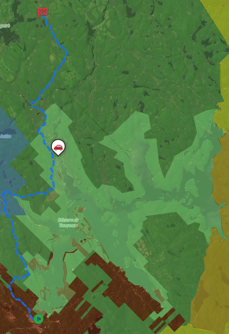
The Itinerary Planner lets you draw any route on the map, split it into segments, and instantly generate offline-ready geo-referenced PDF maps for every leg of your journey.
- Interactive route drawing — freehand or follow roads
- Geo-referenced PDF map for every segment
- Save & revisit your itineraries anytime
- Works offline in the backcountry
Subscriber-only feature — See plans
Download PDF
Generate geo-referenced PDF maps with your selected areas and custom markers for offline use.
How geo-referenced PDF maps work
Get unlimited downloads, private markers, ad-free experience and more with a subscription.
- Unlimited map downloads
- Private markers
- GPX/KML export
- No ads
- Cancel anytime
Free Camping
Discover hundreds of free camping locations on Manitoba crown land
Outdoor Activities
Hiking, fishing, kayaking, lake exploration and much more on Manitoba crown land
Manitoba Crown Land
Manitoba's crown land spans over 50 million hectares across the province, encompassing boreal forest, prairies, wetlands and the Canadian Shield. Managed by Manitoba Forestry and Natural Resources, crown land is accessible year-round for free camping, hunting, fishing, snowmobiling and ATV use. Manitoba's remote north is prized for its pristine wilderness and world-class fishing, while the accessible south offers outstanding waterfowl hunting and sport fishing within reach of major communities.
About →